drone license

Drone photography for real estate agents and property owners throughout Sweden

Overview images are an excellent solution for the construction and real estate industry. By using drone imagery, we can quickly and accurately capture images of land allocations, construction and real estate projects. Using the images, where we model and visualize your property, it becomes easy for you to present the project to customers and stakeholders. In addition, it facilitates the planning and visualization of different options in a smooth way. 

Why drone images?

Increasingly, real estate agents are starting to realize the benefits of using drones for photography and filming when selling properties. One obvious advantage is the ability to capture images from unique angles, such as the bird's eye view and top-down view over the roof that are not possible to achieve with traditional photography methods. This also offers an excellent overview of plots and/or properties, and their surroundings.

Real estate photography

360 drone images

With 360 drone images and an Interactive Digital View, you can experience objects, whether plot, property, mansion, etc. on a completely different level. You get a better overview of the area and can walk around the object digitally - both on the ground and 110 meters above ground level

drone footage for realtors and real estate agents
Real estate photography

Authorization for dissemination of images

In order to ensure that the distribution of drone images and videos to the wider public, which may include use in marketing materials or sharing on digital platforms such as social media, is done legally, it is essential to have a valid dissemination permit.

This requirement is regulated by Lantmäteriet and aims to maintain a controlled handling of aerial images and films to protect the integrity of the individual and ensure that the material is used responsibly.

why drone images

Exception

There are some exceptions to the obligation to apply for a dissemination permit for images taken from aircraft.

Depending on the location and the object, it is not necessary to apply for a permit if, for example, the images only show a residential building with associated land and facilities and public roads.
We will help you either apply for a permit or crop the images to avoid applying for a dissemination permit. 

Spread permit included

When you choose to hire us for drone services, you can rest assured that the right to share these images is included in the service at no extra cost.
     This means that you can easily integrate these unique and eye-catching images into your marketing strategies, which can help your properties stand out in an increasingly competitive market.
     The images, which can include impressive aerial panoramic views, are not only a way to showcase the location of the property and its surroundings in a spectacular way, but also a tool to create a stronger and more memorable image of your offer to potential customers or stakeholders.

READ MORE

Real estate photography for estate agents and property owners

New buildings

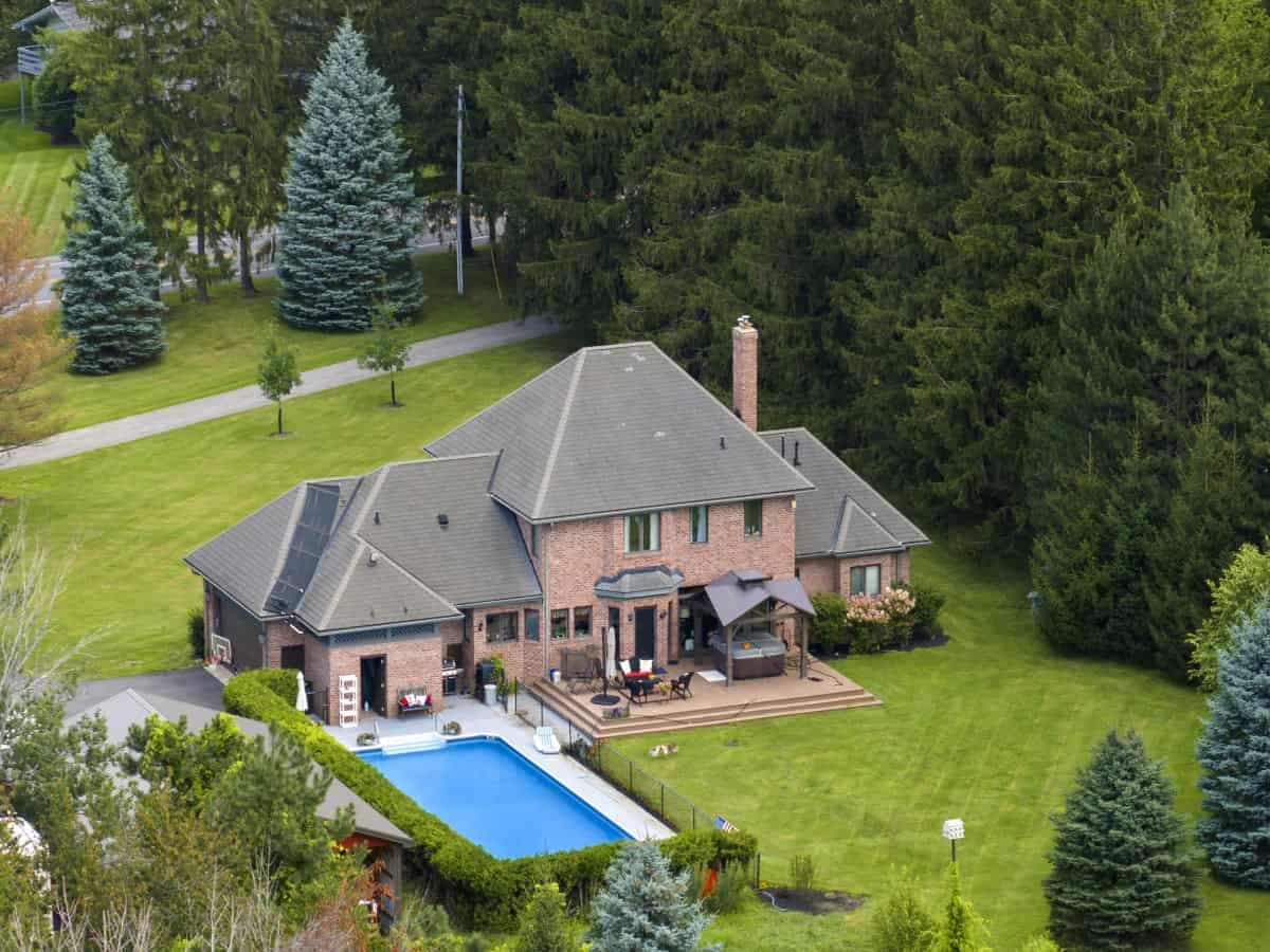
In a new construction project, it is essential to convey the potential and vision of the project to potential speculators and stakeholders, even before the physical structure has taken shape. By offering a visual preview of the future view, using high quality still images and detailed panoramas taken from different heights, stakeholders can get a clear idea of the location of the building and the added value that the view will offer.

These images are not only an effective way to raise interest and expectations, but also serve as an invaluable resource in marketing materials. By integrating these realistic images into brochures, presentation materials and websites, prospective buyers can imagine the life and environment of the future home, strengthening their connection to the project.

Besides traditional uses, these images offer a unique opportunity to enhance and enrich 3D renderings. By using the actual views as a background in these renderings, one can create a more authentic and inviting visualization of the future project. This technique not only helps to illustrate how the building harmonizes with its surroundings but also provides a more concrete and reliable representation of the finished project. This, in turn, can play a crucial role in the decision-making process for potential buyers or investors, as it contributes to a deeper understanding and appreciation of the project's unique features and benefits.

READ MORE

new production2

Area scanning

Drone scanning is an innovative method to quickly and efficiently collect data from large areas or objects. By using advanced drones equipped with high-resolution cameras and sensors, we can capture detailed information from land, buildings or other objects from different angles and perspectives. The collected data is then processed and transformed into an accurate 3D model that can be used to analyse and visualize the environment in a very realistic way.

Using our digital viewing technology, you can easily navigate around the created 3D model. It gives you full control to examine and analyze the object from different angles and zoom in on specific details, just as if you were on site. This is an ideal solution for area scanning, new construction, plot analysis and much more. Our service offers a powerful combination of technology and ease of use to efficiently plan and execute projects with high accuracy.

READ MORE

perimeter scan

Overview images

We are happy to provide you with an overview image based on a drone photograph. This is an excellent solution to showcase an entire area or get a clearer overview of a plot of land, for example. Overview images are particularly valuable for the construction and real estate industry, where we can use drone photography to deliver fast and accurate images of land allocations, construction and real estate projects. By modelling and visualizing your property in the images, you can easily present your project to customers and stakeholders and facilitate the planning and visualization of different options.

READ MORE

dronare new production

DEMO: Area scanning

Compare listings

Compare